
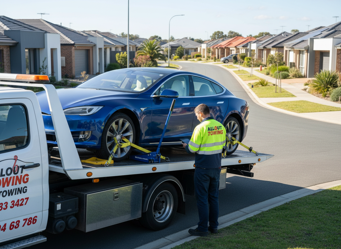
Every breakdown has a pattern. After 15 years towing across Perth’s metro and regional roads, you start to notice them-the same stretch of Tonkin Highway where engines overheat in summer, the corner of Roe Highway where transmission failures cluster, the industrial zones where trucks blow tyres at predictable intervals.
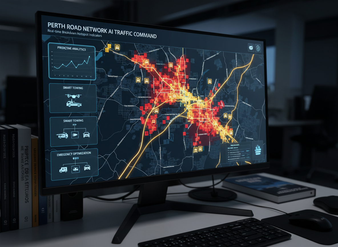
What once lived in a tow operator’s head now lives in algorithms. Smart towing Perth uses artificial intelligence to map breakdown hotspots across Western Australia, predicting where and when vehicles will fail before they do. It’s not science fiction. It’s happening right now, and it’s changing how All Out Towing positions resources across Perth.
The data tells a story. Between 2022 and 2024, WA’s Main Roads recorded over 47,000 roadside incidents requiring assistance or recovery. Most weren’t random. They followed patterns-temperature spikes, traffic density, road surface conditions, even time of day. AI doesn’t just react to breakdowns anymore. It anticipates them.
Why Breakdowns Cluster in Specific Locations
You’d think vehicle failures would scatter randomly across the road network. They don’t. Certain roads, certain conditions, certain times create perfect storms for mechanical failure.
Heat stress zones top the list. When Perth’s temperature climbs above 38°C, cooling systems fail at three times the normal rate. The Kwinana Freeway between Russell Road and Anketell Road sees a spike in overheating incidents every summer, particularly between 2 PM and 5 PM when asphalt temperatures exceed 60°C.
Stop-start traffic destroys transmissions. The Mitchell Freeway northbound approach to Hester Avenue, where traffic slows from 100 km/h to crawling pace during evening peak, generates a disproportionate number of transmission-related callouts. The constant gear shifting under load accelerates wear on clutch packs and torque converters.
Gradient changes expose engine and brake weakness. Greenmount Hill on Great Eastern Highway remains a notorious breakdown zone. Vehicles struggling up the incline overheat or lose power. Those descending ride brakes too hard, leading to brake fade and, occasionally, complete brake failure.
Industrial access roads chew through tyres and suspensions. Roads around Kewdale, Welshpool, and the Latitude 32 Industrial Park see heavy machinery transport, overloaded utes, and trucks operating at maximum GVM. Potholes form faster, debris accumulates, and tyre blowouts multiply.
It’s like trying to make two people walk in different directions while their shoes are tied together-certain road conditions and vehicle vulnerabilities just don’t mix. When they meet, breakdowns happen.
How AI Maps Breakdown Patterns
Artificial intelligence doesn’t predict the future by magic. It learns from the past, then identifies patterns humans miss.
Historical incident data forms the foundation. Every 24-hour emergency towing callout we’ve logged over the past decade-location, time, vehicle type, failure mode-feeds into machine learning models. These models identify correlations between environmental factors and breakdown frequency.
Real-time traffic data adds context. AI systems pull live feeds from Main Roads WA’s traffic monitoring network, tracking congestion, average speeds, and stop-start patterns. When traffic slows unexpectedly on a known hotspot, the system flags elevated breakdown risk.
Weather integration sharpens predictions. Temperature, humidity, wind speed, and rainfall data from the Bureau of Meteorology overlay with historical breakdown patterns. The algorithm knows that a 40°C day with northerly winds increases overheating callouts by 47% in specific corridors.
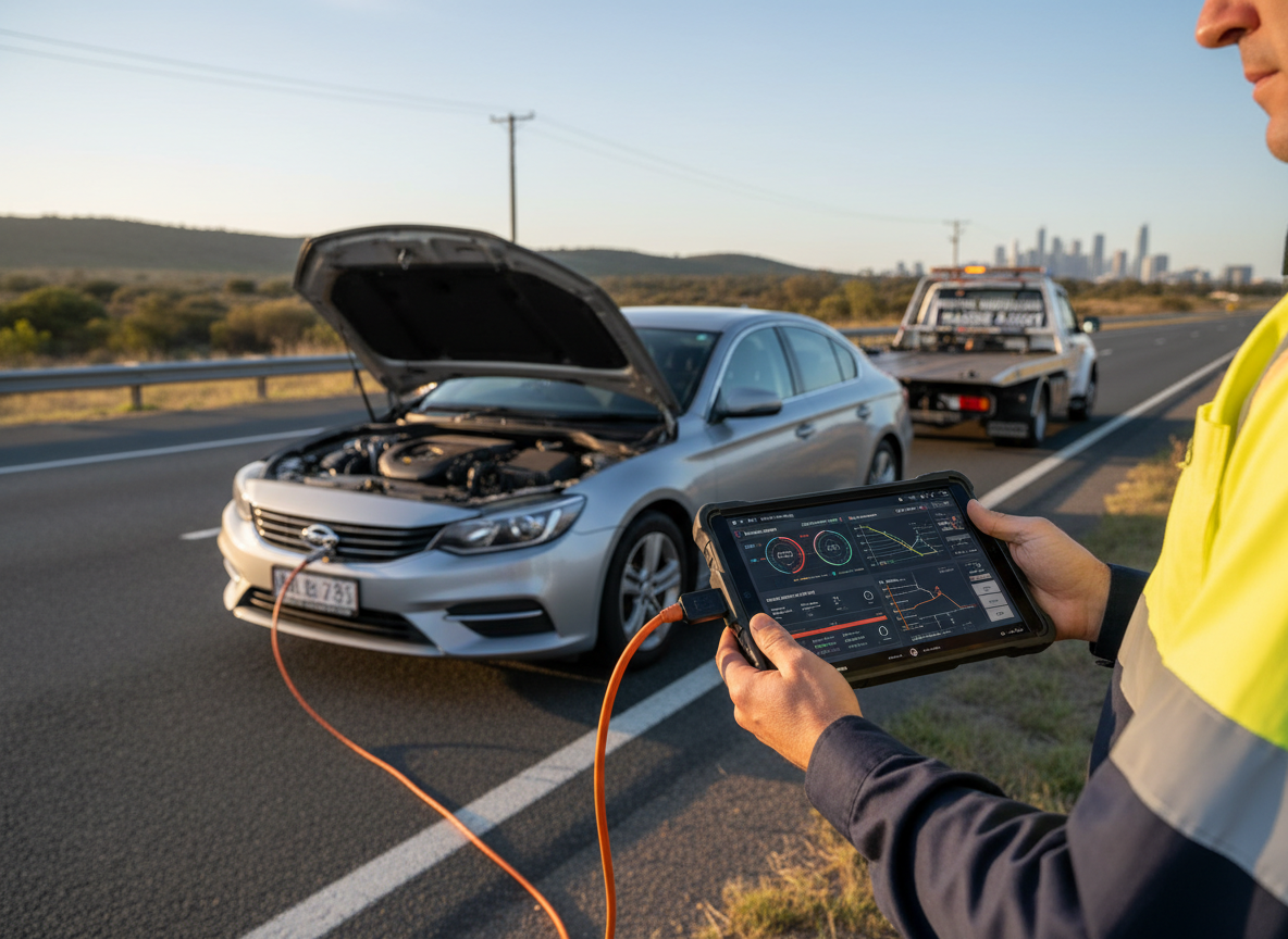
Vehicle telematics closes the loop. Modern vehicles broadcast diagnostic data-engine temperature, battery voltage, tyre pressure, transmission behaviour. Fleet vehicles and connected cars already share this data. When patterns emerge across multiple vehicles in the same location, AI flags the area as high-risk.
The system doesn’t just count breakdowns. It weighs them. A single overheating incident might be random. Ten overheating incidents within 3 kilometres over two hours? That’s a hotspot.
What AI Reveals About Perth’s Breakdown Zones
The data paints a detailed picture of where Perth’s roads hurt vehicles most.
Tonkin Highway between Kelvin Road and Reid Highway shows the highest density of overheating incidents during summer months. The combination of sustained high-speed driving, limited shade, and poor airflow creates a thermal stress corridor. Older vehicles with marginal cooling systems fail here first.
Roe Highway eastbound between Orrong Road and Albany Highway clusters transmission failures, particularly in automatic vehicles. The gradient, combined with heavy traffic during peak periods, forces transmissions to work harder. Vehicles with delayed servicing fail at twice the normal rate in this section.
Great Eastern Highway through Midland and Greenmount remains WA’s most consistent breakdown zone. The steep gradient, combined with heavy truck traffic and high summer temperatures, creates a perfect storm. We’ve logged more truck towing callouts from this 10-kilometre stretch than any other road in the metro area.
Kwinana Freeway between Armadale Road and Rowley Road sees elevated tyre failure rates. The road surface, heavy traffic volumes, and high speeds accelerate tyre wear. Underinflated tyres fail here at predictable intervals, particularly during afternoon heat.
Industrial zones around Kewdale, Malaga, and Bibra Lake generate consistent heavy machinery towing demand. Overloaded vehicles, poorly maintained equipment, and rough road surfaces combine to create mechanical failures. The patterns repeat weekly.
How We Use AI to Position Resources
Knowing where breakdowns will happen changes how we deploy trucks. It’s the difference between reacting and being ready.
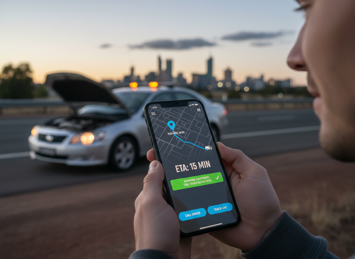
Predictive positioning means placing tilt tray services near high-probability zones before demand spikes. On a 38°C day, we position a truck near Tonkin Highway’s overheating corridor by 1 PM. When the calls come-and they will-response time drops from 35 minutes to 12 minutes.
Dynamic routing adjusts in real-time. If AI flags elevated breakdown risk on Roe Highway eastbound due to traffic congestion and heat, dispatch reroutes available trucks closer to that corridor. We’re not guessing where the next call will come from. We’re calculating probability.
Resource allocation shifts with patterns. Summer demands more trucks near freeway corridors. Winter increases demand for roadside assistance related to battery failures and flat tyres. Regional events-like the Perth Royal Show or major concerts-create predictable traffic surges and breakdown spikes. We staff accordingly.
Proactive customer alerts become possible. If you’ve called us before and your regular route crosses a flagged hotspot, we can warn you. “Great Eastern Highway is showing elevated breakdown risk this afternoon due to heat and traffic. Consider alternative routes or check your coolant before heading out.”
It’s not about replacing the operator’s instinct. It’s about backing that instinct with data.
The Technology Behind Smart Towing
The hardware and software stack that powers predictive towing dispatch isn’t exotic. It’s proven, integrated, and increasingly affordable.
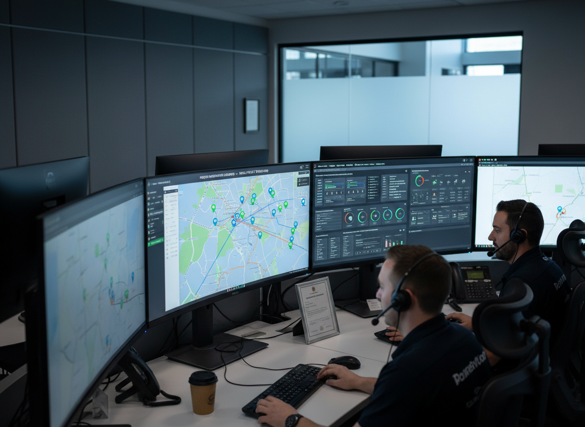
GPS tracking and telematics on every truck in our fleet feeds live location data into the dispatch system. The AI knows where each truck is, what it’s carrying, and how long it will take to reach any point in Perth.
Machine learning algorithms process historical breakdown data, identifying correlations between location, time, weather, and failure type. The models retrain monthly, incorporating new data to improve accuracy.
Cloud-based dispatch systems integrate AI predictions with traditional call management. When a breakdown occurs, the system suggests the optimal truck based on location, equipment, and predicted demand in surrounding areas.
Mobile apps give drivers real-time updates. If AI predicts a surge in demand on a specific route, drivers receive alerts before dispatch calls start flooding in. They’re already moving toward the hotspot.
API integrations pull data from Main Roads WA, Bureau of Meteorology, and traffic monitoring services. The system doesn’t operate in isolation-it synthesises multiple data streams into actionable intelligence.
The cost barrier has dropped. Five years ago, this technology required custom development and six-figure investment. Today, cloud-based platforms offer predictive dispatch tools for a fraction of the cost, making smart towing accessible to operators of all sizes.
What This Means for Drivers and Fleet Managers
Predictive towing doesn’t just help operators. It helps you.
Faster response times mean less time stranded. When we’re already positioned near a breakdown hotspot, you’re not waiting 40 minutes for a truck to arrive from across the city. You’re back on the road faster.
Reduced risk comes from proactive positioning. If you manage a fleet and AI flags elevated breakdown risk on your regular routes, you can adjust schedules, reroute vehicles, or conduct pre-trip inspections to catch issues before they strand a driver.
Lower costs follow faster response. Every minute a commercial vehicle sits broken down costs money-lost productivity, delayed deliveries, customer dissatisfaction. Cutting response time from 35 minutes to 15 minutes saves hundreds of dollars per incident.
Better planning becomes possible. If you’re moving prestige car towing or container transport jobs, knowing which routes show elevated breakdown risk helps you choose safer alternatives or schedule moves during lower-risk periods.
Peace of mind matters most. Knowing that the towing company you’ve called uses data to position resources means you’re not just hoping someone’s nearby. You’re benefiting from systems designed to be there when you need them.
The Limits of AI in Towing
Predictive systems aren’t perfect. They’re tools, not crystal balls.
Outlier events still happen. A vehicle with catastrophic engine failure on a low-risk road at 3 AM doesn’t fit any pattern. AI can’t predict every breakdown-it improves averages, not guarantees.
Data quality determines accuracy. If historical records are incomplete or inaccurate, predictions suffer. Garbage in, garbage out. We’ve spent years cleaning and standardising our incident data to make predictions meaningful.
Human judgment remains essential. An algorithm might suggest positioning a truck near Tonkin Highway, but an experienced dispatcher knows that a major accident has just closed that route, making the prediction useless. AI informs decisions; it doesn’t make them.
Privacy concerns arise with vehicle telematics. Not everyone wants their car broadcasting location and diagnostic data. Predictive systems work best with aggregate, anonymised data-but the more granular the data, the better the predictions. Balancing privacy and utility remains an ongoing challenge.
Cost and complexity still matter. Smaller operators may lack the resources to implement full predictive systems. The technology is democratising, but it’s not universal yet.
What’s Next for Smart Towing in WA
The technology is evolving faster than roads can keep up.
Vehicle-to-infrastructure communication will close the loop. When cars can broadcast diagnostic warnings directly to road networks and towing operators, predictions become near-instantaneous. A vehicle detecting imminent battery failure on Mitchell Freeway could automatically alert dispatch before the driver even pulls over.
Drone surveillance of high-risk corridors could provide real-time visual confirmation of breakdowns, helping dispatch assess severity and assign the right equipment- car towing services for a simple flat tyre, accident towing for a collision.
Integrated emergency response will link towing operators, police, ambulance, and fire services through shared AI platforms. When a breakdown escalates to an emergency, all responders receive coordinated alerts and optimal routing.
Predictive maintenance alerts could warn drivers before breakdowns occur. If your vehicle’s telematics show cooling system degradation and you’re about to drive through a known heat stress zone, you’d receive a warning: “High breakdown risk on your planned route. Consider servicing your cooling system first.”
Autonomous towing vehicles remain further out, but not science fiction. Self-driving tow trucks could position themselves at predicted hotspots without human drivers, reducing response times even further.
The goal isn’t to replace the human side of towing-the calm voice on the phone, the skilled operator securing your vehicle, the reassurance that someone’s looking after you. It’s to make that human expertise more effective, more responsive, and more reliable.
Why This Matters Now
Western Australia’s road network is growing. Traffic is increasing. Vehicles are getting more complex. Breakdowns aren’t going away-they’re multiplying.
Smart towing represents the next step in managing that complexity. It’s about using data to be where you need us, when you need us, with the right equipment and the right expertise.
We’ve spent 15 years learning Perth’s roads the hard way-one callout at a time. Now we’re teaching algorithms what we know, so we can be better prepared for the next call. Yours.
If you’re stuck on the side of the road, you don’t care about AI. You care about how fast help arrives. But behind that fast response is a system that predicted your breakdown before it happened, positioned a truck nearby, and routed it to you in minutes instead of half an hour.
That’s smart towing. And it’s already here.
If you need immediate assistance or want to discuss how predictive positioning can support your fleet, contact us anytime. We’re available 24/7, and our systems are always watching the roads.