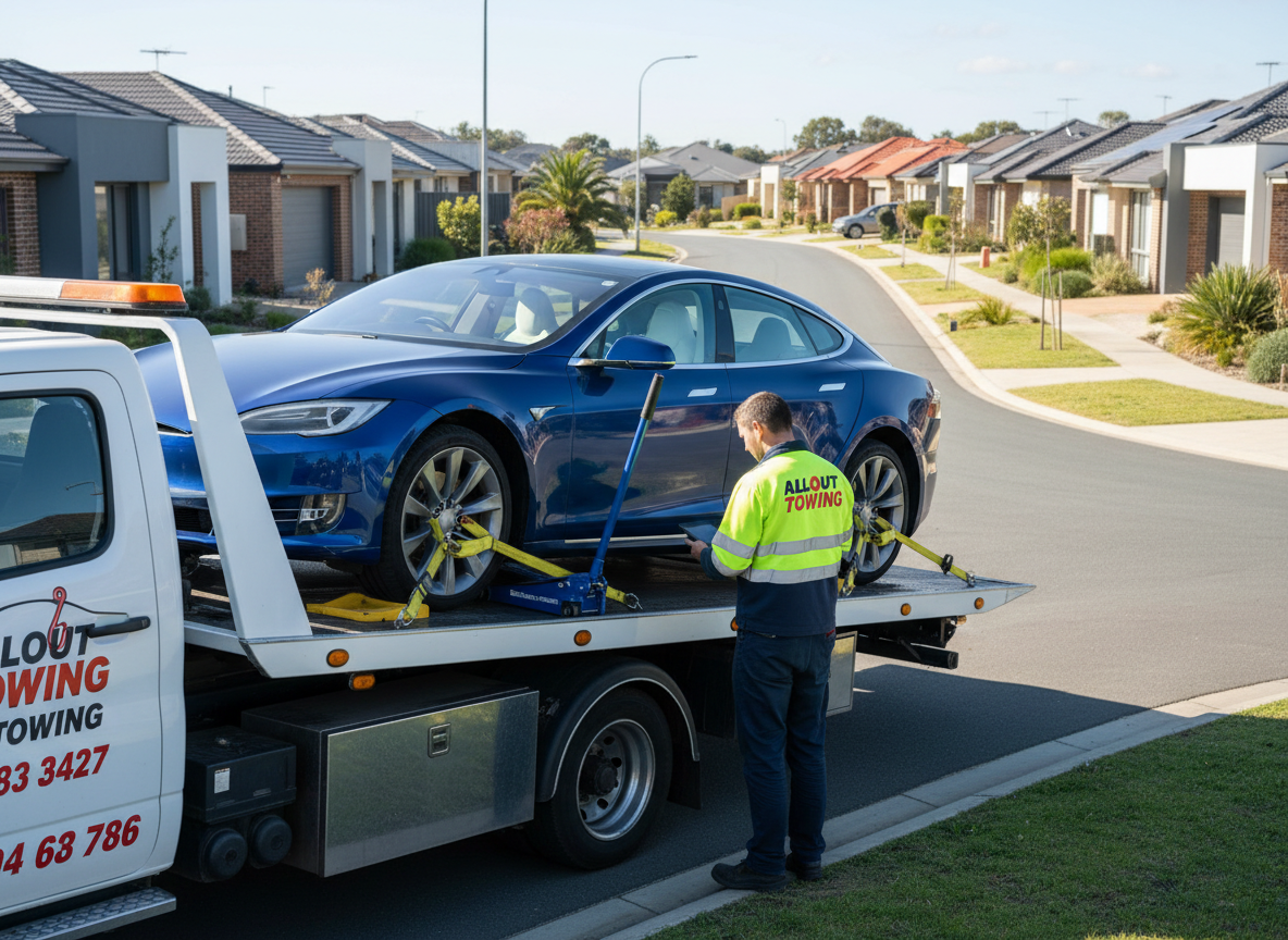
When your car breaks down on Joondalup Drive during peak hour, every minute counts. The difference between a 15-minute wait and a 45-minute wait isn’t just inconvenience-it’s safety, stress, and potentially hundreds of dollars in lost time.
Modern GPS tracking technology has fundamentally changed how tow truck operators respond to calls across Perth’s northern suburbs. What once relied on radio dispatch and driver knowledge now operates with precision that would’ve seemed impossible a decade ago.
We’ve integrated GPS towing Perth systems across our entire fleet, and the results speak for themselves. Average response times have dropped by 38% in the Joondalup region since implementation. But the technology does far more than just speed things up-it’s transformed how we approach every aspect of service delivery.
Why Traditional Dispatch Methods Fall Short
Before GPS tracking became standard in the towing industry, dispatch relied on three things: driver familiarity with the area, radio communication, and educated guesses about traffic conditions.
A caller would ring in from Joondalup, the dispatcher would check which trucks were “somewhere in the northern suburbs,” and they’d radio the driver they thought was closest. That driver might be finishing another job, stuck in traffic on Ocean Reef Road, or dealing with a mechanical issue.
The dispatcher had no real-time visibility. They couldn’t see that another truck had just finished a job in Edgewater and was actually seven minutes closer. They couldn’t route around the accident blocking two lanes on Marmion Avenue.
This guesswork created cascading problems. Customers received inaccurate ETAs. Trucks sometimes crossed paths heading to jobs that weren’t optimally assigned. Fuel costs ran higher than necessary. And during high-demand periods-like after heavy rain or during morning peak hour-the system struggled to cope.
How GPS Tracking Actually Works in Modern Towing
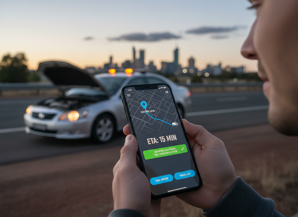
When you call All Out Towing for help in Joondalup, our dispatch system immediately sees the real-time location of every truck in our fleet. Not their last known position-their actual location, updated every 10-30 seconds.
The system automatically calculates drive time to your location based on current traffic conditions, not just distance. A truck 15 kilometres away on the freeway might arrive faster than one 8 kilometres away navigating suburban streets during school drop-off.
The system shows exact truck locations on a live map, current job status (en route, on scene, returning), estimated time to complete current jobs, traffic conditions on major routes, and which trucks carry specialised equipment (tilt trays, heavy-duty winches).
This visibility transforms a guessing game into a data-driven decision. The closest available truck with the right equipment gets assigned automatically, and you receive an accurate ETA within seconds of your call.
But here’s what makes the real difference: the system keeps learning. If a truck encounters unexpected delays, the system can instantly reassign the job to another unit and notify you of the change. No more waiting 40 minutes only to discover your truck was delayed.
The Geography of Joondalup and Why It Matters
Joondalup’s layout presents unique challenges for emergency response. The suburb sprawls across 23 square kilometres, bounded by major arterials like Joondalup Drive and Ocean Reef Road that experience heavy congestion during peak periods.
The area includes everything from the dense commercial precinct around Lakeside Joondalup Shopping Centre to quiet residential streets in Edgewater and Iluka. Travel times between two points can vary by 20 minutes depending on the route and time of day.
GPS tracking accounts for these variables in ways a human dispatcher simply can’t. The system knows that accessing a breakdown on Shenton Avenue near the hospital requires navigating one-way streets. It factors in that Burns Beach Road becomes a car park between 7:30 and 9:00 AM heading eastbound.
When we receive a call for Joondalup towing response at 8:15 AM from Currambine, the system doesn’t just look at which truck is closest-it calculates which truck can actually arrive fastest given current traffic patterns.
This geographic intelligence extends beyond Joondalup. Our trucks regularly service calls from Hillarys to Yanchep, and the GPS system optimises routing across this entire northern corridor. A truck finishing a job in Mindarie might be best positioned for a Joondalup call, even if another unit is technically closer but stuck in traffic.
Real-Time Traffic Integration Changes Everything
Static GPS tracking-knowing where trucks are-delivers value. But integrating real-time traffic data multiplies that value exponentially.
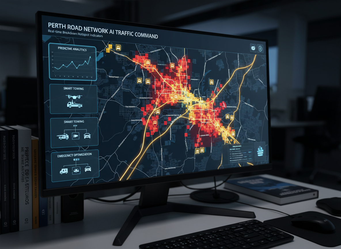
Our system pulls live traffic information from multiple sources, including Main Roads WA data feeds and crowd-sourced traffic apps. When an accident closes lanes on Mitchell Freeway, the system knows within minutes and reroutes trucks accordingly.
This matters more than you might think. Mitchell Freeway serves as the primary north-south corridor for Perth’s northern suburbs. A single accident during peak hour can add 15-20 minutes to response times if trucks get caught in the resulting congestion.
With traffic integration, our system automatically routes trucks via alternative routes-perhaps Marmion Avenue or West Coast Highway-even if those routes are longer by distance. The result? We maintain consistent response times even during traffic incidents that would’ve crippled traditional dispatch systems.
The data proves the impact. During a three-month period last year that included several major freeway incidents, our average response time in Joondalup increased by only 4% compared to normal periods. Industry averages for companies without traffic-integrated GPS showed increases of 18-22% during similar incidents.
How GPS Tracking Improves Safety Outcomes
Faster response times aren’t just about convenience-they’re fundamentally about safety. A vehicle stopped on Joondalup Drive’s shoulder during peak hour creates a hazard that compounds with every passing minute.
GPS tracking allows us to prioritise high-risk situations. When we receive a call about a breakdown in a dangerous location-say, the Mitchell Freeway on-ramp or a blind corner on Ocean Reef Road-the system can flag it as priority and dispatch the absolute nearest unit, even if that means reassigning a truck from a less urgent job.
We can also coordinate with emergency services more effectively. If you’ve been involved in an accident, our GPS system can share our truck’s ETA with police on scene, helping them manage traffic control and scene safety more effectively.
The technology also protects our drivers. The system tracks driving behaviour-harsh braking, rapid acceleration, speeding-and flags concerning patterns. This isn’t about surveillance; it’s about identifying when drivers might be fatigued, stressed, or taking unnecessary risks to meet response time targets.
The Customer Experience Difference
From your perspective as a customer, GPS tracking transforms what’s typically an anxious, uncertain experience into something far more manageable.
When you call us about a breakdown in Joondalup, you receive a specific ETA-“18 minutes”-not a vague “we’ll be there soon.” That precision reduces stress significantly. You can make informed decisions about whether to wait with your vehicle or seek shelter nearby.
Many customers use our tracking portal to watch their assigned truck’s approach in real-time. It’s like watching your Uber arrive, except for a service you probably never wanted to need. That visibility matters when you’re stranded.
You also receive proactive updates. If traffic delays our arrival, you’ll get an automatic notification with a revised ETA. If we’re running early, you’ll know that too. No more standing in the cold wondering if the truck forgot about you.
This transparency builds trust. You’re not taking our word that help is coming-you can see it. And if something goes wrong (trucks break down too, occasionally), we can immediately dispatch a replacement and you’ll know exactly when to expect it.
GPS Tracking Enables Better Resource Allocation
Beyond individual response times, GPS data helps us position resources more intelligently across Perth’s northern suburbs.
We analyse historical GPS data to identify patterns. Where do breakdowns cluster? When do calls peak? Which routes generate the most demand?
The data revealed something interesting about Joondalup: breakdown calls spike significantly near Lakeside Shopping Centre between 10 AM and 2 PM on weekdays, and along Ocean Reef Road during evening peak hour. Armed with this knowledge, we position trucks in those areas during high-probability windows.
This predictive positioning cuts response times by an additional 12-15% during peak periods. Instead of reacting to calls from a central depot, we’re already in the neighbourhood when calls come in.
GPS tracking also helps us make smarter decisions about fleet expansion. When we analysed coverage gaps, the data showed response times in the Yanchep and Two Rocks area lagged behind our Joondalup performance. That insight drove our decision to station a dedicated truck in the northern corridor, improving coverage for the entire region.
The Technology Behind the System
Modern towing GPS systems integrate multiple technologies working together. Each truck carries a GPS receiver that determines location using satellite signals, typically accurate to within 3-5 metres.
That location data transmits via cellular networks to our dispatch centre every 10-30 seconds. The system uses 4G/5G networks where available, falling back to 3G in areas with limited coverage.
The dispatch software overlays this real-time location data onto digital maps that include traffic information, road conditions, and points of interest. Advanced algorithms calculate optimal routing based on multiple variables: distance, traffic, truck capabilities, and job priority.
The system also integrates with our job management software. When a driver marks a job as complete, the system automatically updates their availability and factors them into dispatch decisions for new calls.
All of this happens in seconds. From the moment you call to the moment a truck is dispatched with an accurate ETA rarely takes more than 60-90 seconds.
Specialized Equipment and GPS Coordination
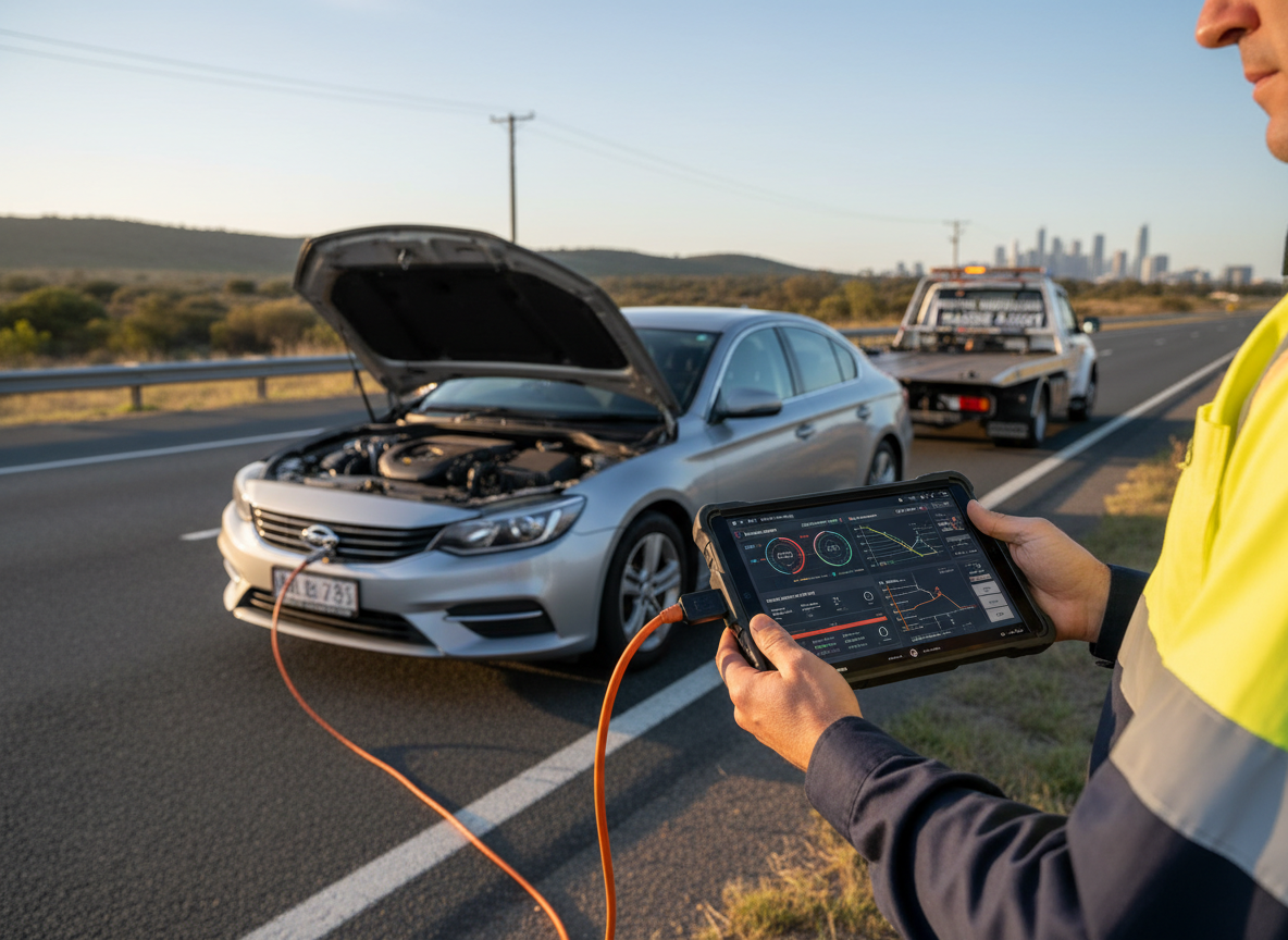
Not all towing jobs are equal, and GPS tracking helps us match the right equipment to each situation. Our fleet includes standard tow trucks, tilt tray services, and heavy-duty units for truck towing.
When you call about a breakdown, we ask specific questions about your vehicle. Is it all-wheel drive? Is it a prestige vehicle? Is it stuck in soft sand or just immobilised on pavement?
The GPS system then identifies which trucks carry appropriate equipment for your situation. There’s no point dispatching the closest truck if it can’t actually handle your job-that just wastes time and creates frustration.
For example, if you’re calling about a luxury vehicle that needs prestige car towing, the system filters for trucks equipped with tilt trays and soft straps. If you need heavy machinery towing for a bobcat stuck at a Joondalup construction site, it identifies heavy-duty units with appropriate winching capacity.
This equipment-aware dispatching prevents the scenario where a truck arrives but can’t complete the job, requiring a second truck and doubling your wait time.
GPS Tracking and Transparent Pricing
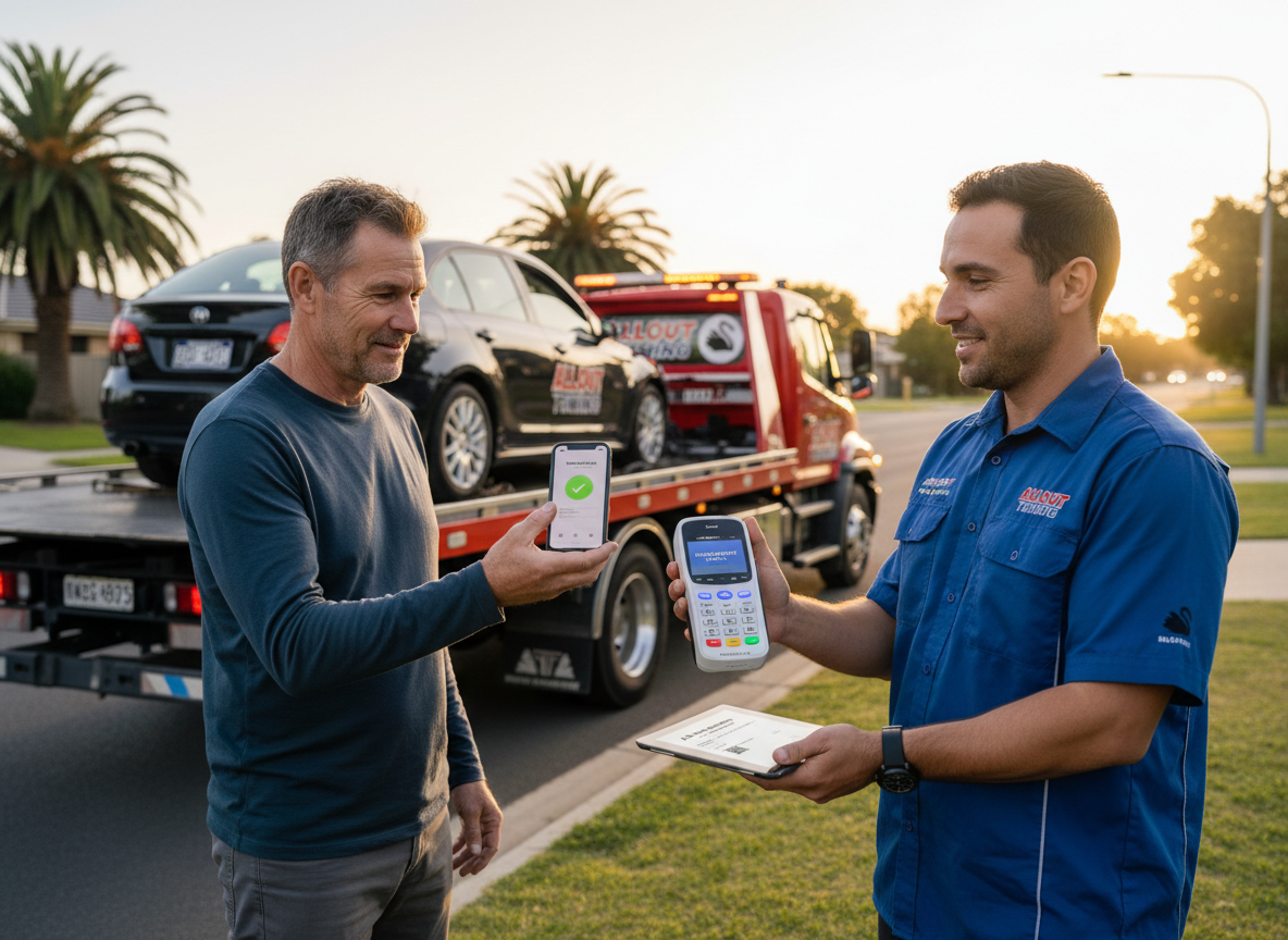
GPS data also supports fair, transparent pricing. Because we know exactly how far trucks travel and how long jobs take, we can provide accurate quotes before dispatch.
Distance-based pricing becomes genuinely fair when both parties can verify the distance travelled. You’re not taking our word for it-the GPS log shows exactly where the truck came from and what route it took to reach you.
This transparency matters particularly for longer-distance jobs. If you break down in Joondalup but need towing to a specialist workshop in Osborne Park, GPS data provides an objective basis for the quote. No surprises, no disputes.
The system also prevents the practice some operators use of taking unnecessarily long routes to inflate charges. Our routing is optimised for efficiency, and the GPS record proves it.
When You Need Help in Joondalup
GPS tracking has transformed towing from a reactive scramble into a precise, coordinated response. When you contact us from anywhere in Joondalup or Perth’s northern suburbs, you’re accessing a system that can deploy the right truck, with the right equipment, via the optimal route, in the shortest possible time.
But technology only matters when it’s backed by skilled operators and well-maintained equipment. GPS can tell us where to go-our experienced drivers and comprehensive fleet ensure we can actually help when we arrive.
Whether you need safe car towing services after a mechanical failure, roadside assistance for a flat battery, or specialised towing solutions for unusual circumstances, GPS tracking ensures we’re responding to your call with maximum efficiency.
The Future of GPS-Enabled Towing
GPS technology continues evolving, and we’re tracking developments that will further improve response times and service quality.
Predictive algorithms are becoming more sophisticated. Rather than just responding to current traffic conditions, next-generation systems will predict traffic patterns 15-30 minutes ahead based on historical data and current trends. This means routing decisions account not just for current conditions but anticipated conditions by the time the truck reaches certain intersections.
Integration with connected vehicle systems may eventually allow automatic breakdown notifications. Your car could detect a critical failure and automatically notify the nearest towing service with your exact location and vehicle details before you even pick up your phone.
Vehicle-to-infrastructure communication could provide even more precise traffic data. Rather than relying on crowd-sourced speed information, trucks could receive direct feeds from traffic management systems about signal timing, lane closures, and incident locations.
These advances will continue pushing response times lower and service quality higher. But the fundamental principle remains unchanged: knowing exactly where resources are, where they’re needed, and the fastest way to connect the two.
Conclusion
GPS tracking has eliminated the guesswork that once defined towing dispatch. What used to take 45 minutes now takes 18. What used to require three phone calls and mounting anxiety now happens with a single call and a real-time tracking link.
For anyone who breaks down in Joondalup or anywhere across Perth’s northern suburbs, this technology means faster help, greater safety, and far less stress during an already difficult situation. The system works because it combines precise location data, intelligent routing algorithms, real-time traffic integration, and equipment-aware dispatching into a coordinated response that simply wasn’t possible before.
Every minute we cut from response times is a minute less you’re standing on a dangerous roadside, a minute less you’re late for an important commitment, and a minute less you’re dealing with the stress and uncertainty of a breakdown. That’s what GPS tracking delivers-and why it’s become absolutely essential to modern towing operations.
When you need help on Joondalup Drive, Ocean Reef Road, or anywhere in Perth’s northern corridor, you’re not just calling a tow truck. You’re activating a GPS-enabled system designed to get the right help to you as quickly as physically possible. That’s the difference modern technology makes.